"Airmate" implemented OFMA Charts
New free Application for flightplanning including OFMA products
Airmate ( www.airmate.aero) is a new and free flight planning app currently available on iOS (iPhone and iPad), and for which an Android release is planned by the end of the year.
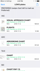
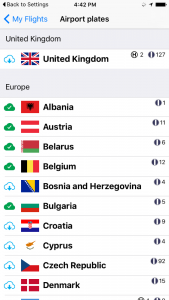
Like OpenFlightMaps, Airmate philosophy is to provide free of charge updated aeronautical data to all pilots. Airmate embeds a worldwide AIRAC database updated every month and provides flight planning features, weather and NOTAM retrieval, moving chart during navigation, flight recording and playback. Airmate also includes a powerful airport plates manager allowing to select and download free of charge all IFR and VFR charts for more than 60 countries, including all Europe and US. Once downloaded, airport plates are available offline during flight. Airmate is evolving to offer more and more social sharing features, for example pilots may rate visited airports and share their tips and advices concerning them.
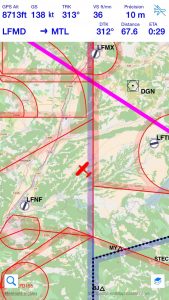
In standard mode, Airmate will dynamically create a full aeronautical map, by overlaying an OpenStreetMap standard topographic map with aeronautical data (airports, regulated areas, radio beacons, waypoints, airways…).
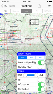
You could fully replace in a given area this dynamically generated map by an aeronautical chart from OpenFlightMaps. If there is an OpenFlightMaps chart for your home country, Airmate will recommend it to you at application launch automatically. Otherwise, for other countries, you could select and download OpenFlightMaps charts using the " Manage Charts" choice in Airmate Settings. A list of available charts is then displayed so you could select those you want.
Once such a chart overlay is downloaded, you could activate it anytime. To this end, press the button “Layers” at the bottom right of the chart. You will be shown the list of downloaded chart overlays and could select the associated switch to activate it.
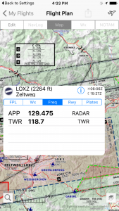
When an aeronautical chart overlay is activated, it will replace both the OpenStreetMap default topographic map and the Airmate aeronautical data within its boundaries. This means that for example airfields or regulated areas will no longer be displayed on top of the chart by Airmate as the OpenFlightMaps chart already embeds those data. But Airmate is still providing active content, and will display the associated information with a single press or a long press is done. If you click on an airport, you will still have the airport popover window that will present you airport weather, frequencies, runways and IFR/VFR charts.
The " Layers" button includes a Chart Overlay switch to request Airmate to display its own data on top of the OpenFlightMaps chart. This could lead to a cluttered display, but this function is very useful to compare aeronautical data from both sources.
